A rod loaded in its holder at dawn with the shoreline behind.

See exactly what you’ll get.

A plan built for a customer’s September 25–27 Everett coho trip. Two things are removed from the public copy: the customer’s name, and the route coordinates. Nothing else is changed, and nothing on it is a mockup.

01 / The StrikePlan

Read it the night before.

All nine pages of a finished plan, and the Cockpit Card. Tap any page to open it full size, or open the PDF.

Two things are removed: the customer’s name, and the route coordinates — those are the part you are paying for. Everything else is exactly as it shipped.

  • 01Briefing
  • 02Conditions
  • 03Loadout
  • 04Get fishing
  • 05The water
  • 06The water
  • 07Decisions
  • 08Keep & ID
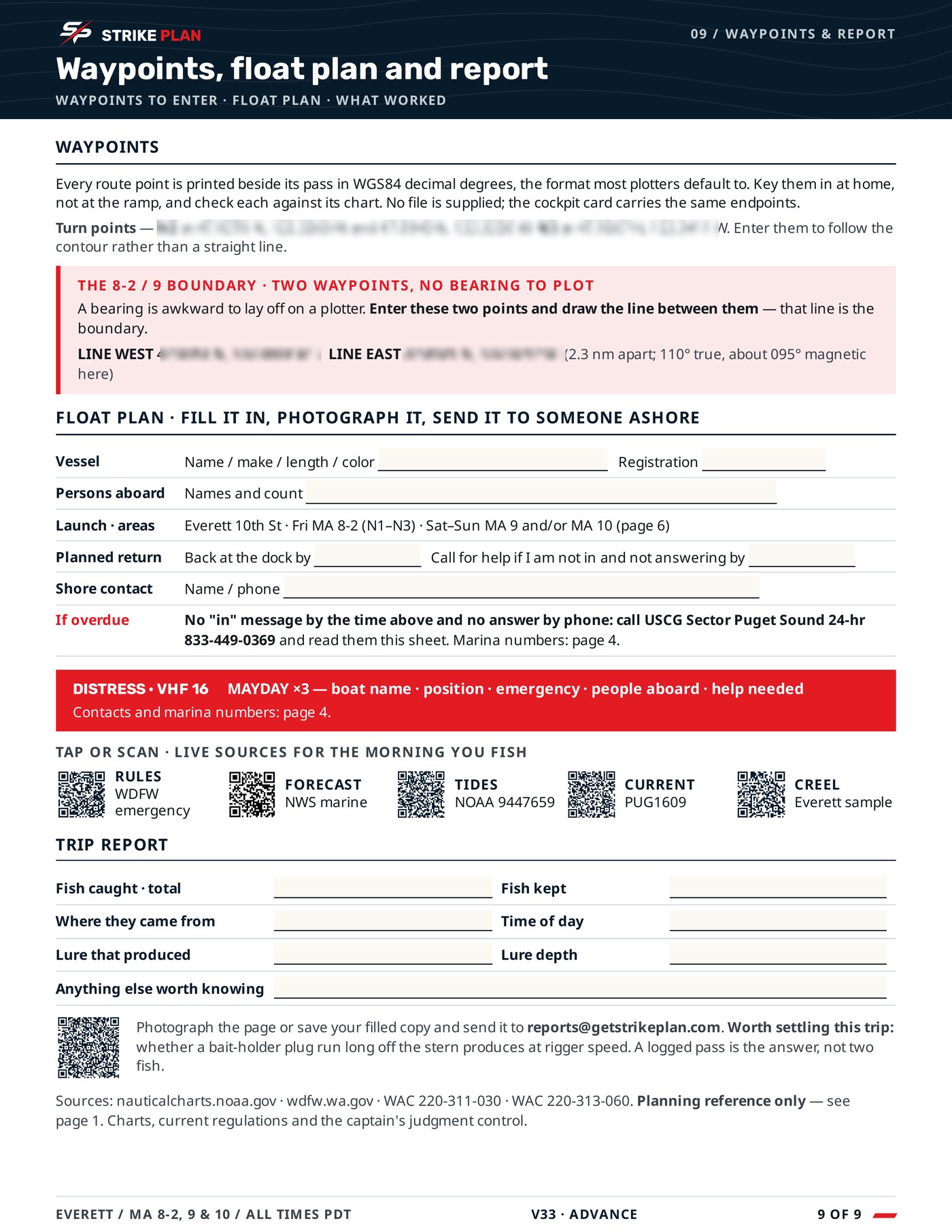
  • 09Waypoints
  • +Cockpit Card
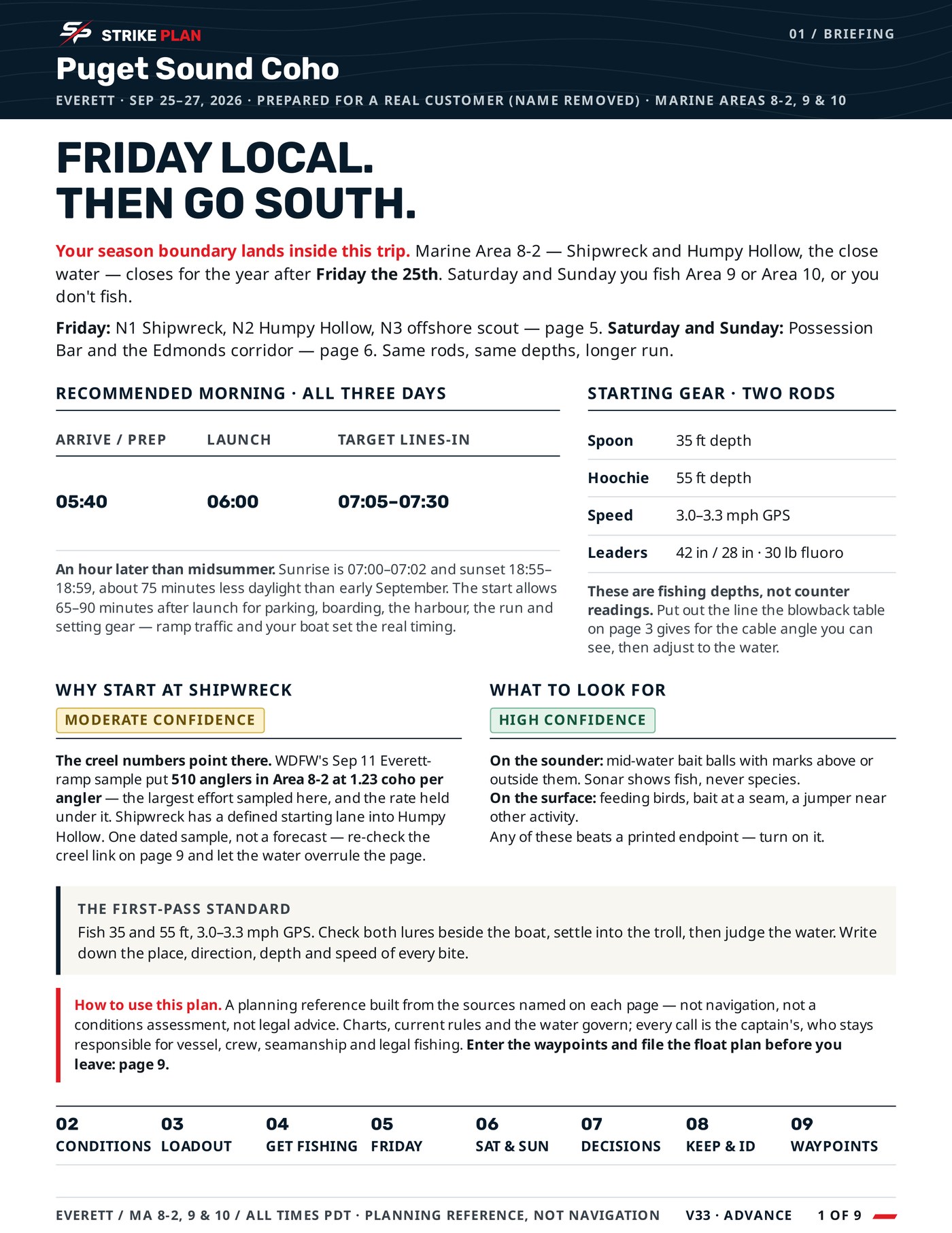
Page one: the shape of the trip, the season boundary that changes it, recommended morning timing and starting gear.
01 — Briefing
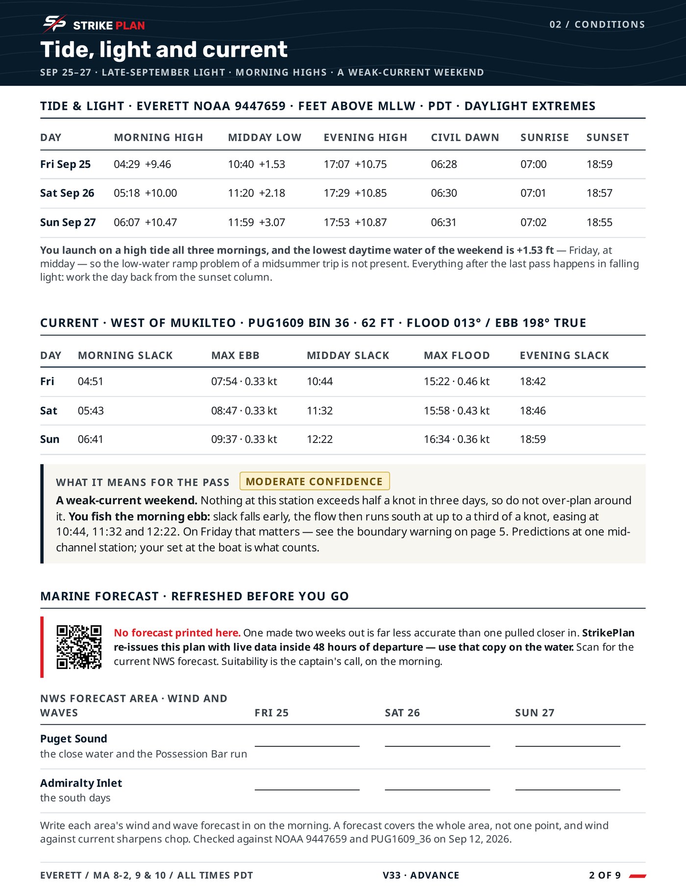
Tide, current and light: slack times, tide heights and the timing that shapes the fishing day.
02 — Conditions
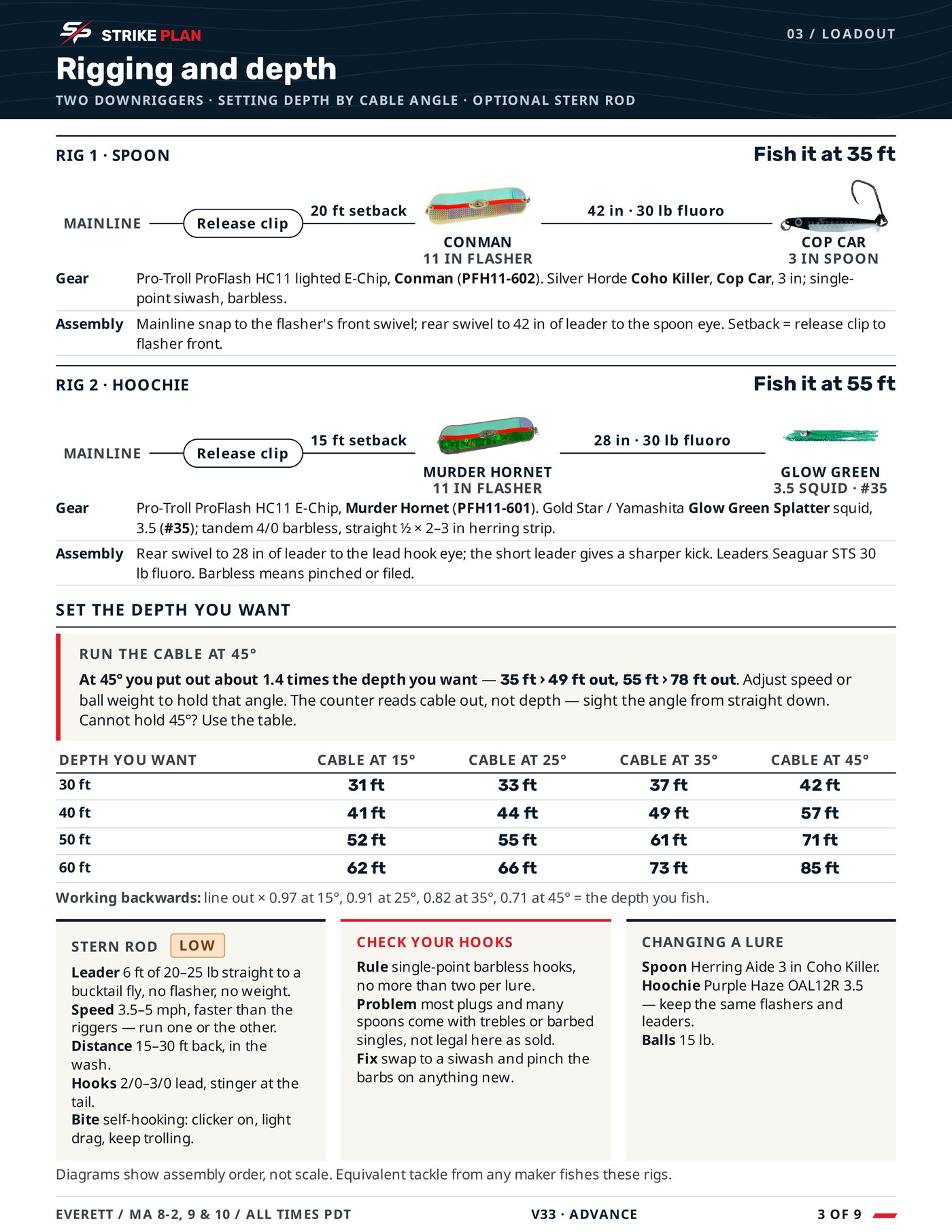
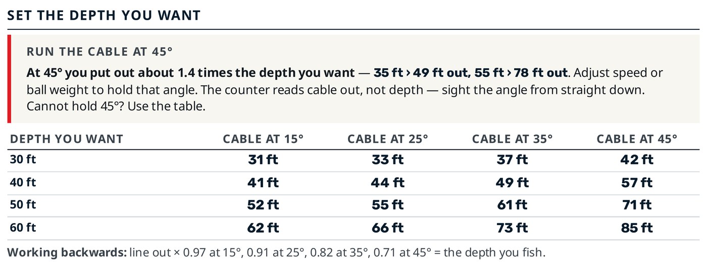
Rigging and depth: two downrigger setups, leaders and terminal detail, and the cable-angle table.
03 — Loadout
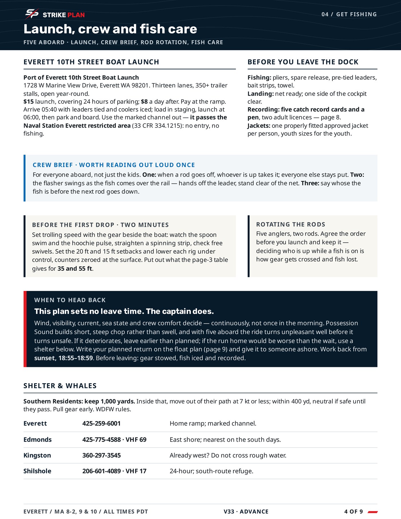
Launch, crew and fish care: the ramp, what to do before the first drop, and handling what you keep.
04 — Get fishing
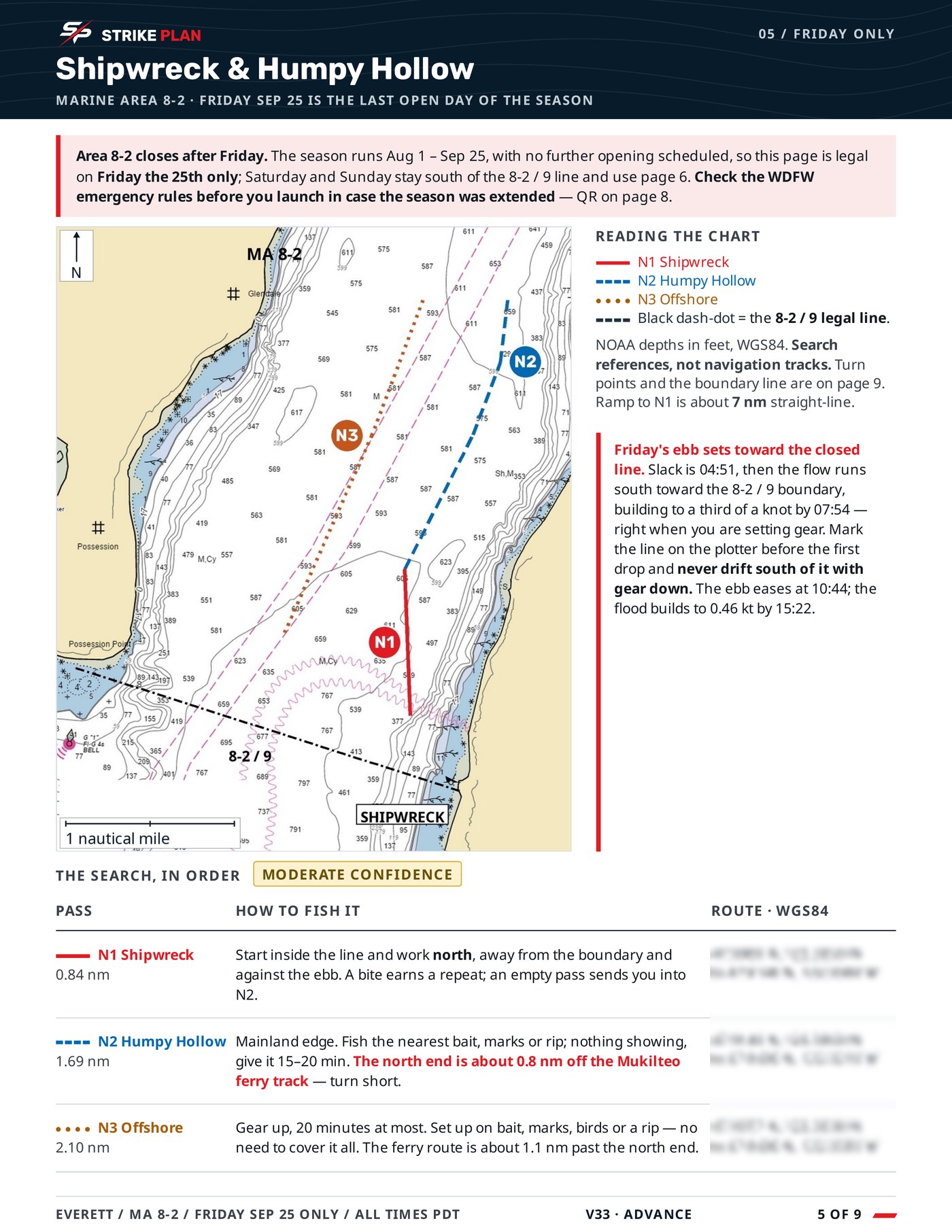
A chart page with the starting sequence drawn on it and a table saying how to fish each pass.
05 — The water
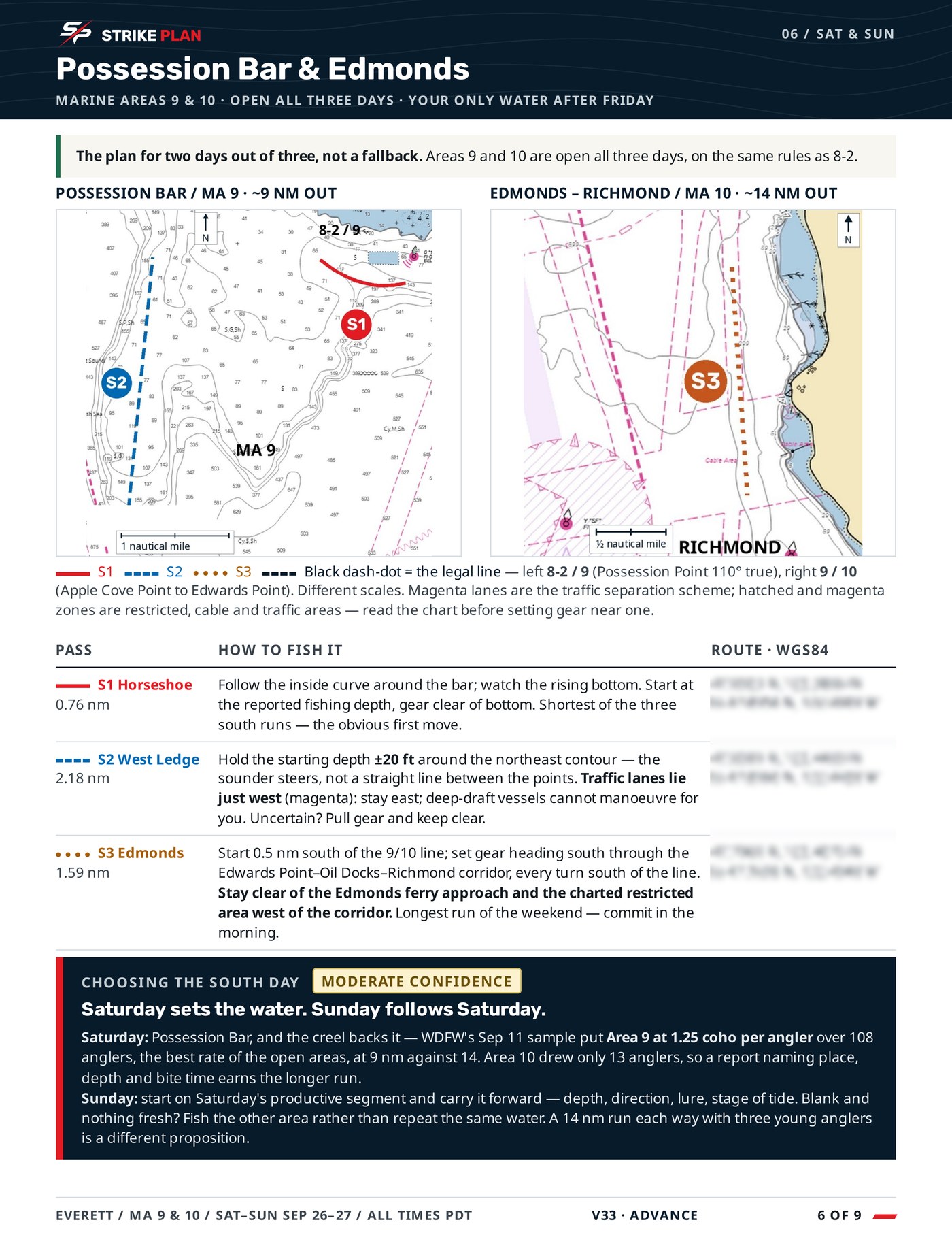
The second chart page: the water for the rest of the weekend, marked the same way.
06 — The water
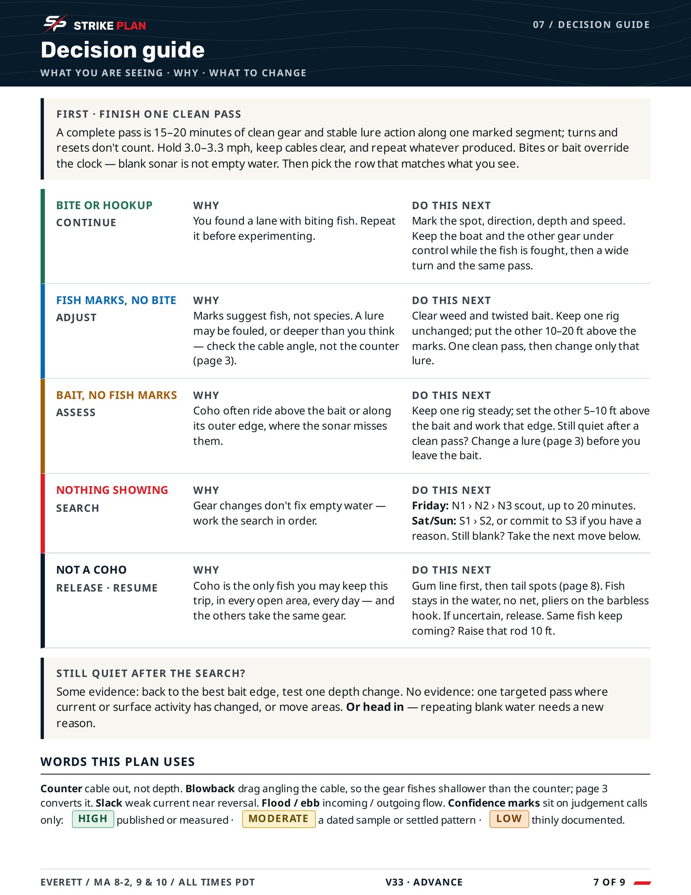
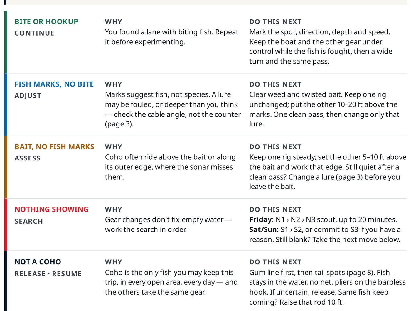
The decision page: stay, change one thing, or move, with the conditions that trigger each.
07 — Decisions
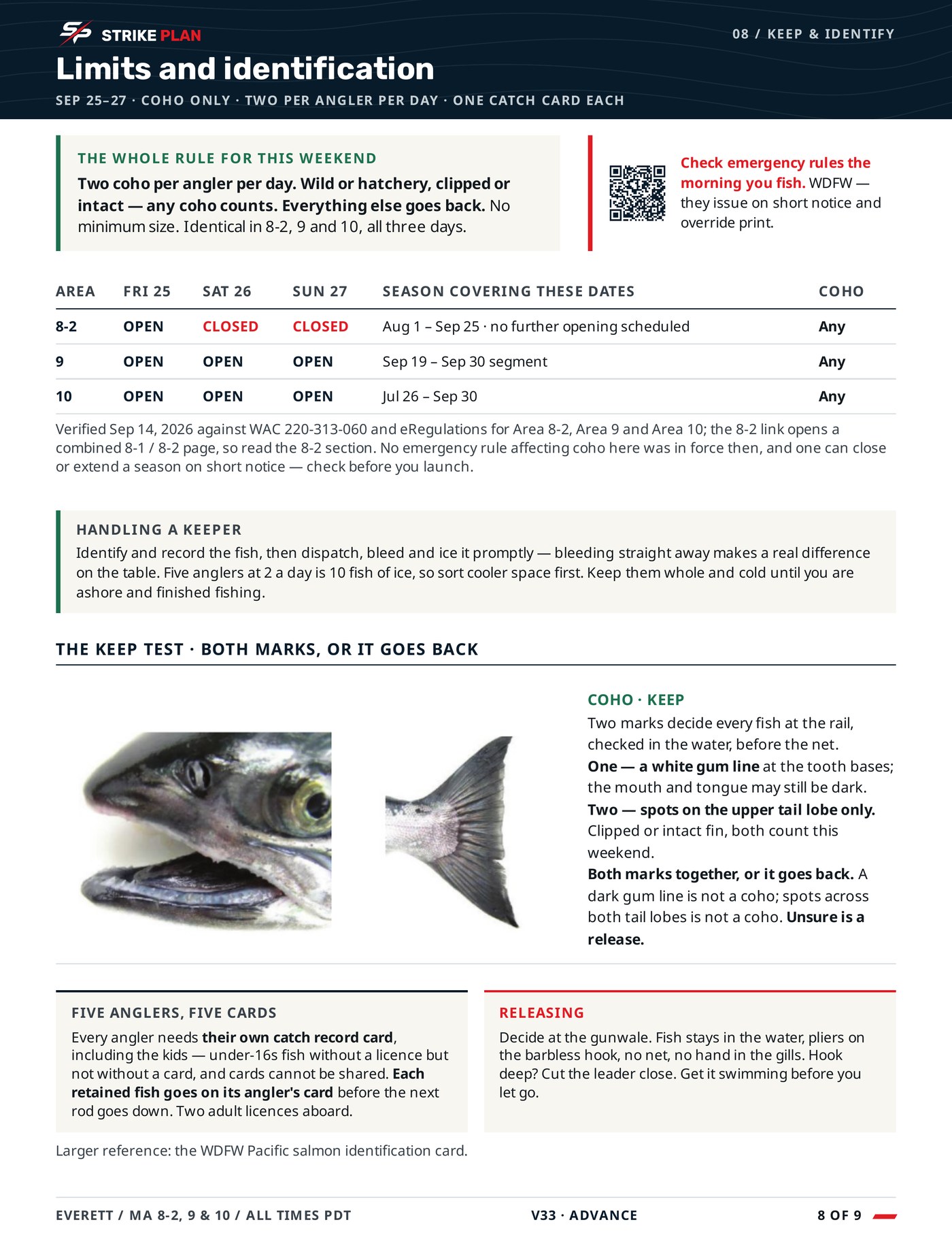
Limits and identification: the keep test for the target fish and the card rules that apply.
08 — Keep & ID
Waypoints, float plan and report: the marks written out for manual entry, and what to send back.
09 — Waypoints

Swipe to see all nine →

Ten pages, 4 MB. Coordinates are blurred in this copy and printed in full in the plan you receive.
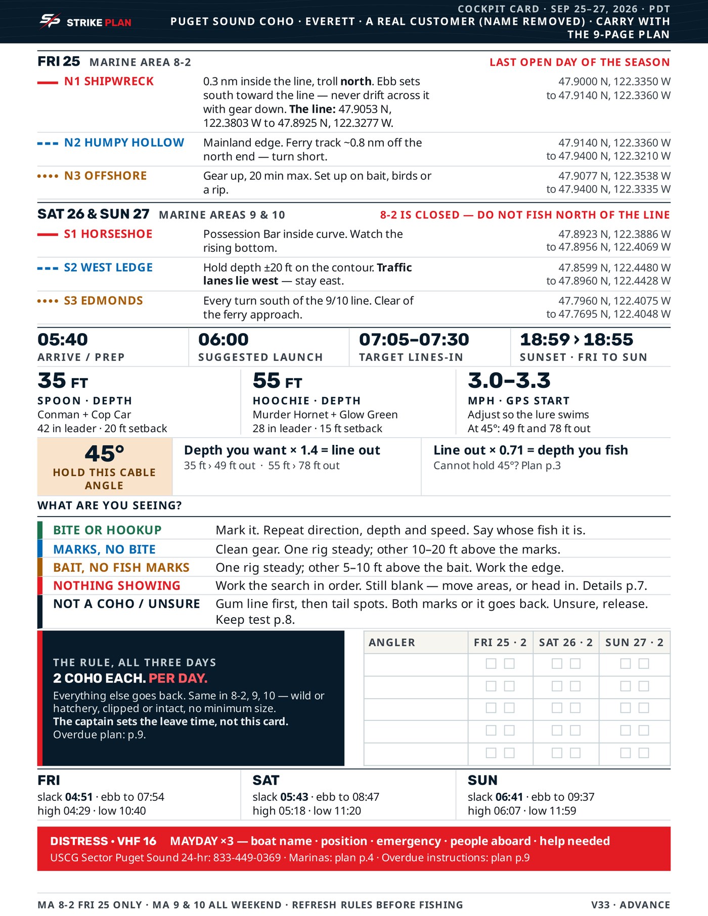
The one-page StrikePlan Cockpit Card with coordinates, routes, depths, limits and the distress call in red.

02 / The Cockpit Card

One page. Built for the boat.

Everything you need underway, on a single page you can keep in reach with wet hands.

Coordinates and routes

Every mark where you can reach it.

Cable angle at a glance

Your cable angle, so you know your real depth without guessing.

Limits and the distress call

Printed in red, where you’d want them.

03 / How to read it

Three pages, at the size they are printed.

Shrunk to a thumbnail, any document looks like any other document. These are printed here at the size you would read them.
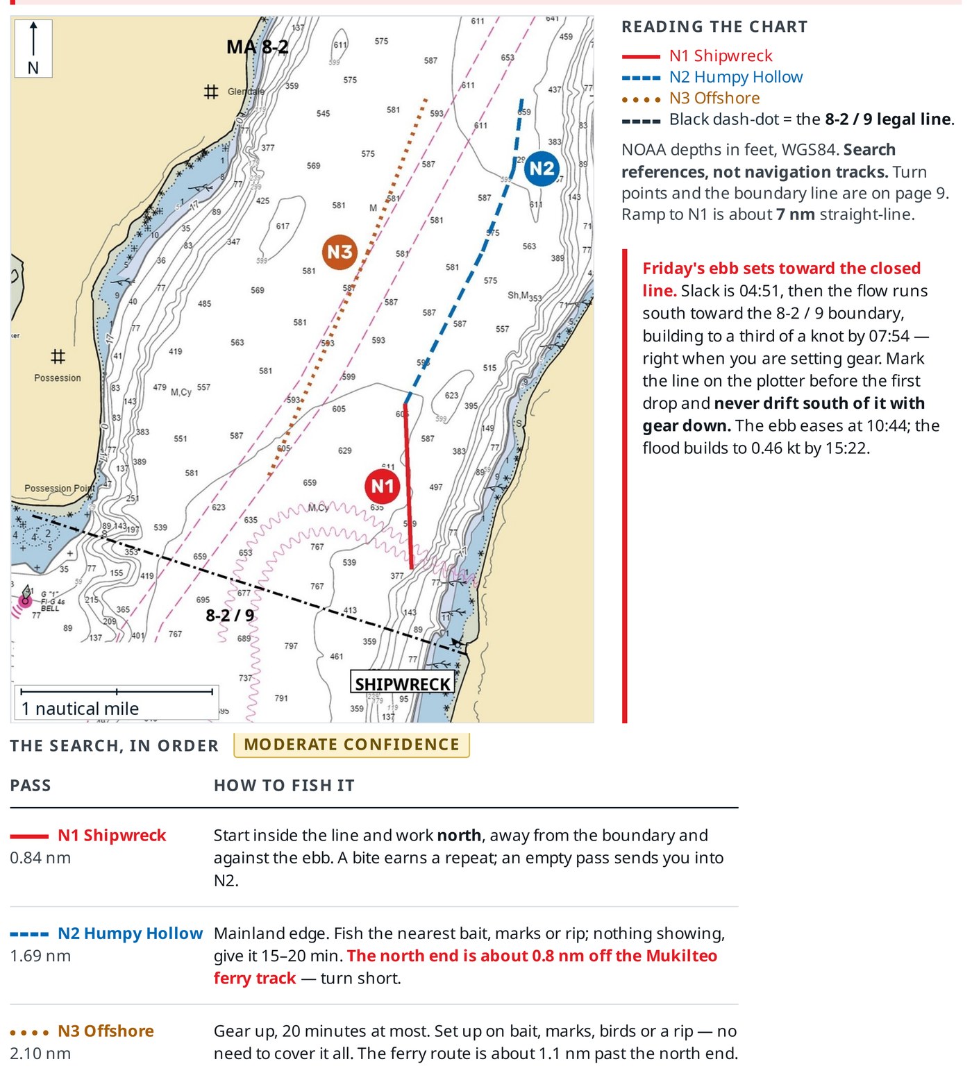
A chart page from a StrikePlan: three marked passes with coloured tracks, the legal boundary line, and a table saying how to fish each one.
Page 5 — the waterCoordinates are printed in the plan you receive.
Setting depth by cable angle: hold 45 degrees, which puts out about 1.4 times the depth you want, with the full conversion table.
Page 3 — setting depth
The decision page: what you are seeing, why, and what to do next, colour-coded by state.
Page 7 — the decision page
On a phone these two pages are shown small on purpose. They are US Letter pages of operational type — tap either one, or open the PDF, to read them at full size.
The bow of a boat at dawn with the console silhouetted against a low sun.

Stop researching. Start with a plan.

Tell StrikePlan where you’re going. We’ll turn the homework into something you can actually fish.

The plan supports your judgment. It doesn’t replace current regulations, navigation charts or a safe call on the day.